Partnership will test future eVTOL flight routes and concept of operations in the Kansai region Photo: Airbus Airbus is partnering with Japanese helicopter operator Hiratagakuen to develop advanced air mobility services in the Kansai region and beyond. Through this agreement, the…
BAE Systems has received a $ 13 million contract for advanced GPS technology to protect U.S. F-15E aircraft from GPS signal jamming and spoofing. The company’s Digital GPS Anti-jam Receiver (DIGAR) will ensure the reliability of military GPS systems for…
Photo: traveler1116/iStock/Getty Images Plus/Getty Images GNSS researchers are presenting hundreds of papers at the 2022 Institute of Navigation (ION) GNSS+ conference, taking place Sept. 19–23 in Denver, Colorado, and virtually. The following five papers focus on GNSS receiver technology and…
Nino De Falcis By Nino De Falcis, Senior Director of Business Development, ADVA Today’s critical network infrastructure is heavily reliant on positioning, navigation and timing (PNT) services. Power grids, financial markets, transportation, data centers, communications — all have become more…
Compared to the other three GNSS constellations, what is currently the greatest strength of GPS? What is its greatest weakness? Jules McNeff “I’ll second Bernie’s comments and add that the nearly universal trust in GPS, despite the protestations that it…
The Hawaiian Volcano Observatory (HVO) of the U.S. Geological Survey has been working to rebuild its geodesic monitoring network after lava consumed several GNSS stations in 2018. The work began following the 2018 Kīlauea lower East Rift Zone eruption and…
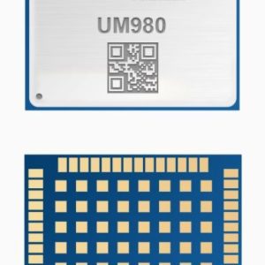
Photo: Unicore Unicore Communications has released its new generation of high-precision GNSS module. The UM980 uses real-time kinematic (RTK) technology to achieve centimeter-level positioning accuracy. The UM980 is based on the small high-performance system-on-chip NebulasIV, which integrates radio frequency, baseband…
A roundup of recent products in the GNSS and inertial positioning industry from the August 2022 issue of GPS World magazine. OEM Receiver Module Designed for autonomous applications Photo: Trimble The Trimble BD9250 dual-frequency receiver module supports Trimble RTX correction services…
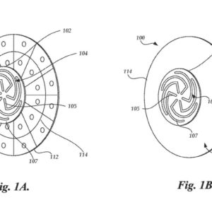
Tesla has applied to patent a new multi-band GNSS antenna with increased precision for self-driving and navigation in its autos, reports electrek. The antenna would be positioned inside the rear-mirror enclosure, and the system would also provide a heating element.…