Image: Bluesky Bluesky International and SkyFi have collaborated to provide access to Earth observation assets and multi-perspective imagery to users globally. Bluesky is providing its high-resolution aerial imagery, taken by aircraft-mounted cameras, to SkyFi to make available for businesses,…
Image: Septentrio Septentrio, a leader in high-precision GNSS positioning solutions, has launched the Agnostic Corrections Partner Program. The program facilitates the use of Septentrio receivers with high-accuracy services that provide varying levels of accuracy, coverage and delivery methods. This…
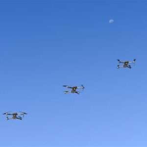
Image: Air Force Staff Sgt. Rachel Simones/ Department of Defense. BAE Systems and Lockheed Martin Skunk Works partnered to test the Skunk Works Stalker and Indago UAS on BAE Systems’ amphibious combat vehicle (ACV) command, control, communication and computers…
We’re helping communities prepare for and adapt to the effects of rising heat — from new extreme heat alerts on Search to AI-powered tools for cities and governments. Maps
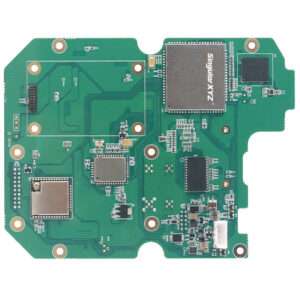
Image: SingularXYZ SingularXYZ, a manufacturer of GNSS technology, has launched its DK100 development kit. This multi-functional kit has selectable single-antenna and dual-antenna modules, full constellation tracking and centimeter-level positioning. The DK100 development kit is a ready-to-use kit designed to…
Image: SimActive Sharper Shape has used SimActive software’s distributed processing capabilities to complete utility corridor base maps in Montreal, Canada. In 2022, more than eight million images were collected in SimActive’s Correlator3D software to generate orthomosaics and colorized point clouds.…