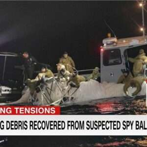
Feb. 4 saw the news networks alive with sometimes wild reports about UFOs, UAVs and then a balloon. Balloons are used for weather forecasting on a regular basis, launched daily into the stratosphere with payloads gathering wind speed and direction,…
The Linux Foundation has launched the Overture Maps Foundation, interoperable open map data for developers who build map services or use geospatial data and to strengthen mapping services globally. Overture expects to release its first datasets in the first half…
Image: Cepton Cepton has secured a multi-million-dollar contract from the United States Highway Tolling System Operator to use its Sora series lidar sensors. The sensors will be deployed on several major tollways in the tri-state area in Northern California. The…
Image: Percepto Transport Canada has approved Ontario Power Generation (OPG) to operate Percepto’s drone-in-a-box solution beyond visual line of sight (BVLOS) at McConnell Lake Control Dam without a visual observer on site. A BVLOS Special Flight Operations Certificate was issued…
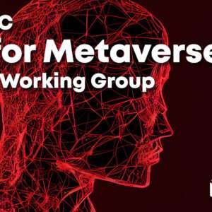
Image: OCG The Open Geospatial Consortium (OGC) has formed the Geo for Metaverse Domain Working Group (DWG), which will serve as a forum for the collective geospatial expertise of the OGC community to gather to help build and expand the…
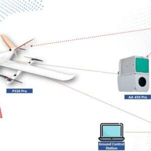
Image: CHCNAV CHC Navigation’s mobile mapping solutions, the P330 Pro vertical take-off and landing unmanned autonomous vehicle (VTOL UAV) and the AlphaAir 450 lidar, are being used for mining exploration in Indonesia. The solutions help with effective data collection…
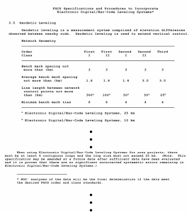
My previous column provided an update on the current set of published orthometric heights in the southeast Texas region and rules by the National Geodetic Survey (NGS) for estimating and publishing GNSS-derived orthometric heights using OPUS Projects. It also highlighted…