Image: shaunl/ Getty Images On Nov. 18, the European Space Agency (ESA) announced a Navigation Innovation and Support Programme (NAVISP) partnership with Italy’s Grimaldi Group, as the need for accurate maritime navigation increases. With the Grimaldi Group, NAVISP has…
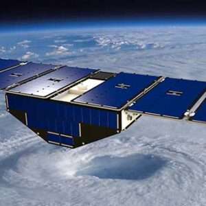
Artist’s concept of one of the eight CYGNSS satellites in orbit. (Image: NASA/University of Michigan) Since Nov. 26, NASA’s Cyclone Global Navigation Satellite System (CYGNSS) team has not been able to make contact with one of the eight CYGNSS spacecraft,…
Image: Copyright Trelleborg AB On Dec. 15, Trelleborg Marine and Infrastructure released SafePilot P3, a navigation system that meets Panama Canal Advisory (ACP) standards, which go into effect late next year for Neopanamax vessels. The navigation system provides real-time data…
Image: iStock/Getty Images Plus/Getty Images The 2023 European Navigation Conference (ENC) will take place May 31 – June 2 with a focus on resilient navigation. This conference, which will welcome professionals from the positioning, navigation, and timing (PNT) field, is…
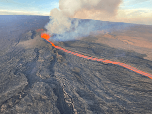
Image: USGS In late November, the Mauna Loa volcano in Hawaii erupted for the first time since 1984 and is currently in an active volcanic eruption. Scientists are using satellites and helicopters to record and map the flow of…
Geodesy without math equations: Is that possible? The answer is no, but basic geodetic concepts can be described without using complex math equations. My previous column addressed the geodesy crisis in the United States. The newsletter was highlighted on LinkedIn…