Yang Changfeng, Chief Architect, BeiDou Navigation Satellite System. (Photo: BeiDou) By Yang Changfeng Chief Architect, BeiDou Navigation Satellite System As one of the core Global Navigation Satellite Systems (GNSS) providers, the BeiDou Navigation Satellite System (“BDS”) has been developed steadily…
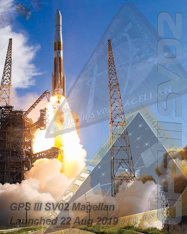
By Colonel John Claxton Chief, PNT Mission Integration, Air Force Space and Missile Systems Center Image: USAF The Global Positioning System has provided the citizens of the United States and the world the gold standard for positioning, navigation and timing…
Photo: ResponDrone Emergency response providers participating in a Design Thinking workshop organized by the ResponDrone Project have indicated that they would like to use drones to gather and distribute crucial information and provide communication networks in disaster areas. Preliminary results…
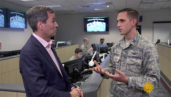
Screenshot: CBS News On CBS’ Sunday Morning show Dec. 1, correspondent David Pogue was invited into the Air Force’s GPS Master Control Station at Schriever Air Force Base in Colorado Springs, Colorado, to show viewers what GPS is all about.…
What is or would be the best policy response from Congress and/or executive branch agencies to the growing threats to GPS from jamming and interference? Brad Parkinson “Homeland Security has declared GPS to be an essential system to virtually all…
Photo: Trimble Trimble has acquired Cansel Survey Equipment’s Can-Net and AllTerra New Zealand’s iBase networks. The acquisitions significantly increase the global footprint of Trimble-owned Virtual Reference Station (VRS) networks by adding key geographies in North America and New Zealand. Subscription-based…
GE Aviation and Hybrid Project team to provide commercial high-endurance vertical takeoff and landing (VTOL) UAV, with Auterion and GE Aviation providing comprehensive integration of ground, cloud and airborne components GE Aviation has teamed with Hybrid Project to provide a…
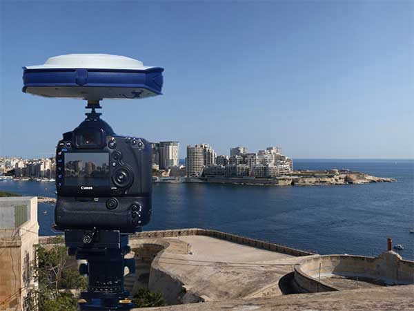
Photo: Spectra Precision Verified photomontages for UNESCO World Heritage sites achieves accuracy with Spectra Geospatial SP80 Verified photomontage is an important planning tool to envision how proposed surrounding development plans would affect UNESCO World Heritage sites. Verified photomontage demands the…