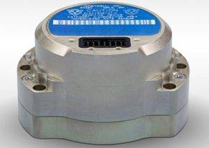
Photo: HoneyWell Honeywell displayed its HG4930 MEMS-based inertial measurement unit (IMU) at Xponential 2019, which took place April 29-May 2 in Chicago. The company emphasized the IMU’s rugged design, which the company says allows the IMU to meet the needs…
Geneq Inc., a manufacturer and provider of GNSS receivers and positioning solutions to GIS professionals and surveyors, has launched its newly designed website. The website features new functionalities, better product viewing options, and improved product support options. The completely redesigned…
Sitelink 2.0. (Photo: Topcon) Topcon Positioning Group is offering a new edition of its real-time 3D job site monitoring and management system — Sitelink 2.0. The update includes a new pay-as-you-go point-based service model, new features to Sitelink Support Desk,…
Photo: CHC Navigation Shanghai-based GNSS technology and solutions company Shanghai Huace Navigation Technology Ltd. — known as CHC Navigation — has opened a North American subsidiary, CHC Navigation USA Corporation, in Scottsdale, Arizona. CHC Navigation was established in 2003 and…
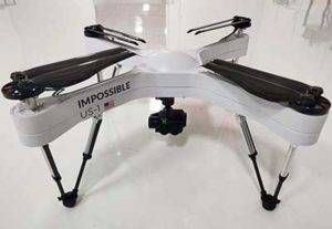
Photo: Impossible Aerospace Auterion and Impossible Aerospace has announced their partnership and collaboration to bring to market the US-1 UAV, which has a two-hour flight time. Auterion is the provider of Auterion Enterprise PX4, an open-source-based, enterprise operating system for drones. Impossible Aerospace is Silicon…
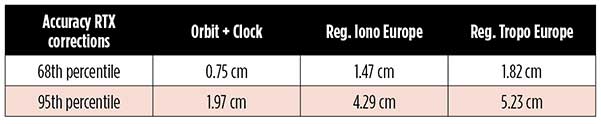
By Markus Brandl, Xiaoming Chen, Herbert Landau, Carlos Rodriguez-Solano and Ulrich Weinbach This article updates a July 2012 feature in GPS World, “Real-Time Extended GNSS Positioning: A New Generation of Centimeter-Accurate Networks.” The Trimble CenterPoint RTX correction service, enabling centimeter-level…
A European region in 2015. (Image: OpenStreetMap) A tool developed by Mapbox explores “10 years of OpenStreetMap.” During that decade,hundreds of thousands of people mapped 25 million miles of roads in every country in the world. The internet tool uses…
By Urs Niesen, Jubin Jose, Xinzhou Wu, Qualcomm Technologies Inc. Emerging automotive applications require reliable but at the same time low-cost positioning solutions. In this paper, we present such a solution by fusing the measurements from several consumer-grade sensors using…