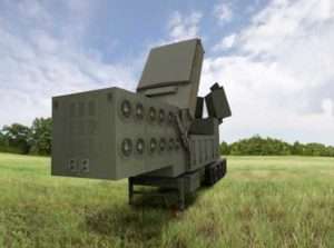
Orolia, through its Orolia Government Systems business, has been selected by Raytheon Missiles & Defense to support the U.S. Lower Tier Air and Missile Defense Sensor (LTAMDS) radar program with its low SWaP (size, weight and power), rugged time and…
Photo: Parrot Drone maker Parrot is supporting French medical professionals facing the COVID-19 pandemic by helping Makers for Life design the MakAir respirator. This partnership comes as a part of their MakAir open source respirator project. According to Parrot, it…
Orthometric height support (survey-grade elevations) enables Arrow GNSS receivers to collect high-accuracy, survey-grade vertical data with any data-collection software. Eos Positioning Systems Inc. has announced support for GEOID height models within its Arrow Series GNSS receivers. Eos manufactures high-accuracy GNSS…
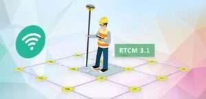
Makers of mobile GIS app SuperSurv, developed by Supergeo Technologies Inc., are working to increase its GNSS positioning functionality. In recent weeks, the SuperSurv product team began to enhance SuperSurv’s NTRIP solution, aiming to adopt more RTCM versions and provide a…
Marines to get upgraded smartphones for close-air supportC4ISR & NetworksForward observers, air controllers and joint terminal attack controllers will receive an upgraded Target Handoff System (THS), which is a portable system designed for use by dismounted Marines to locate targets,…