News from the European Space Agency The test version of a unique satellite navigation receiver has been delivered for integration testing on the Lunar Pathfinder spacecraft. The NaviMoon satnav receiver is designed to perform the farthest ever positioning fix from…
Graphic: GPS World An expert has warned the government of the United Kingdom that the lack of an alternative to Galileo threatens to put critical infrastructure at risk, according to a report in Daily Express. Andy Proctor, formerly with the…
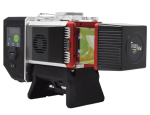
Photo: GeoCue GeoCue, a U.S. LiDAR data technology company, has announced its latest True View 3D Imaging Systems (3DIS) product, the True View 645/650. Combined with GeoCue’s integrated data processing software suite, True View EVO, all GeoCue 3DIS products include…
Photo: EvgeniyShkolenko/iStock/Getty Images Plus/Getty Images Hackers in China managed to gain entry into satellite operators, defense contractors and telecommunications companies in the United States and southeast Asia, reports Reuters. Reuters spoke with security researchers at Symantec Corp. ahead of public…
The longer days in the U.S. have us chasing that windows-down-music-up-breeze-blowing kind of road trip feeling. Whether you’re planning a getaway to the coast to get a dose of Vitamin D or a weekend reunion to see friends and family,…
April 7 is National Burrito Day in the U.S. So get ready to roll over to your favorite burrito joint and treat yourself to the extra guac. Whether you like your burrito in a bowl or rolled, take a bite…
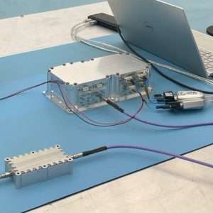
Photo: Fixposition Fixposition, a Swiss technology company providing high-precision positioning solutions, has released a centimeter-level positioning sensor, the Vision-RTK 2. The low power and compact, industrial-grade device is suitable for autonomous delivery and logistics vehicles, agriculture, mowing and landscaping machines, as…
Building a map is complex, and keeping it up-to-date is even more challenging. Think about how often your city, town or neighborhood changes on a day-to-day basis. Businesses and shops open and close, stretches of highway are added, and roadways…